12810 Old Oregon Trail, Redding, California 96003
- Shasta County Assessor's Parcel Number 014-430-062
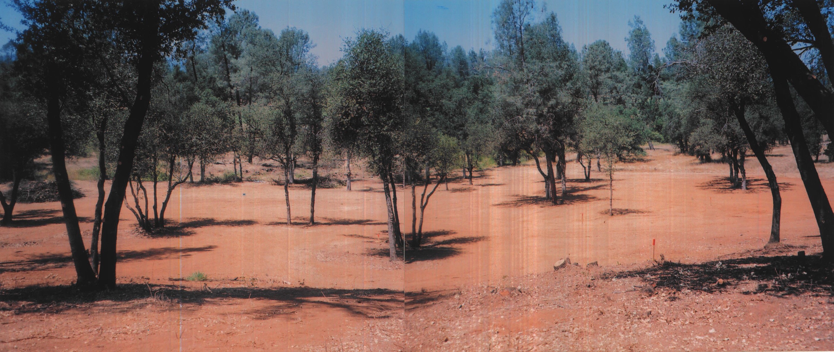
- A 5.38-acre lot, fully graded and developed - shovel ready
Features
- 5.38 acres.
- Located in the incorporated City of Redding, California.
- Only 2.4 road miles east of Interstate Highway 5. (Exit number 682 at Oasis Road, then east for the entire distance to the lot which is on the left side of Old Oregon Road.)
- No freeway traffic noise can be heard from the designated building pad on this lot.
- Lot is 1,100 linear feet long with City of Redding paved road frontage, known as Old Oregon Trail.
- This area of Old Oregon Trail is subject to becoming a dead end street, when the planned road alignment is installed to the east. Development fee payments are in a trust for this new road alignment which is shown on maps as behind the row of homes across the street from this property.
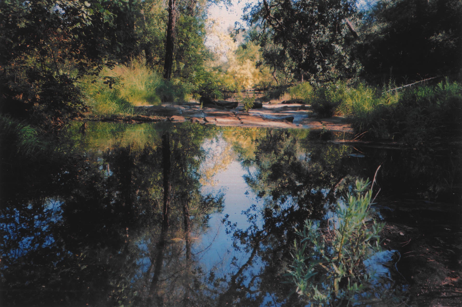
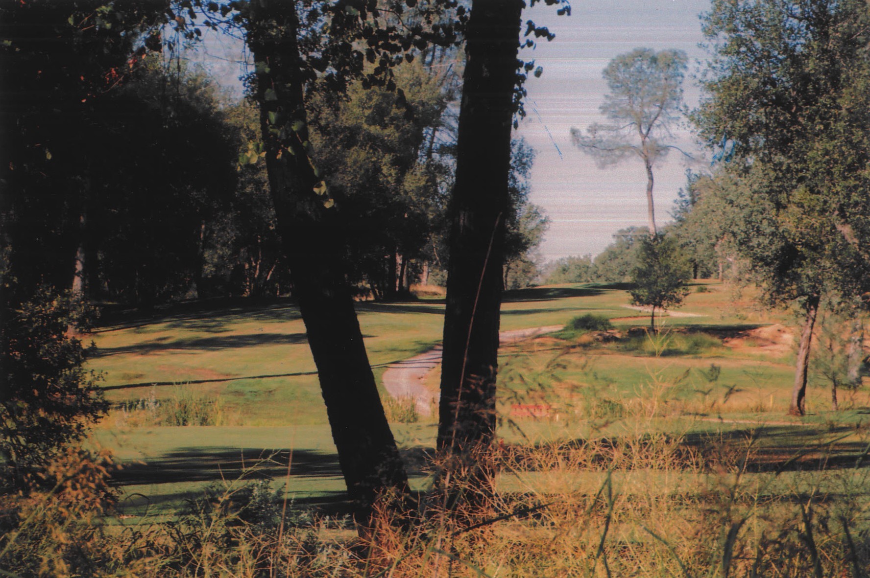
- This lot faces the 13th and 14th fairways of the Tierra Oaks Golf Course.
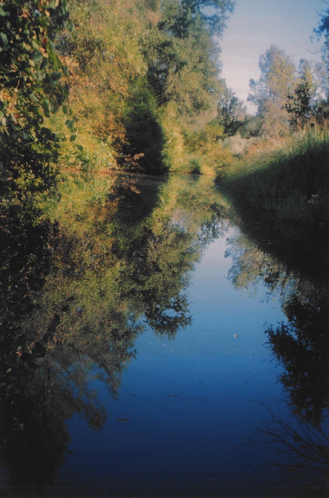
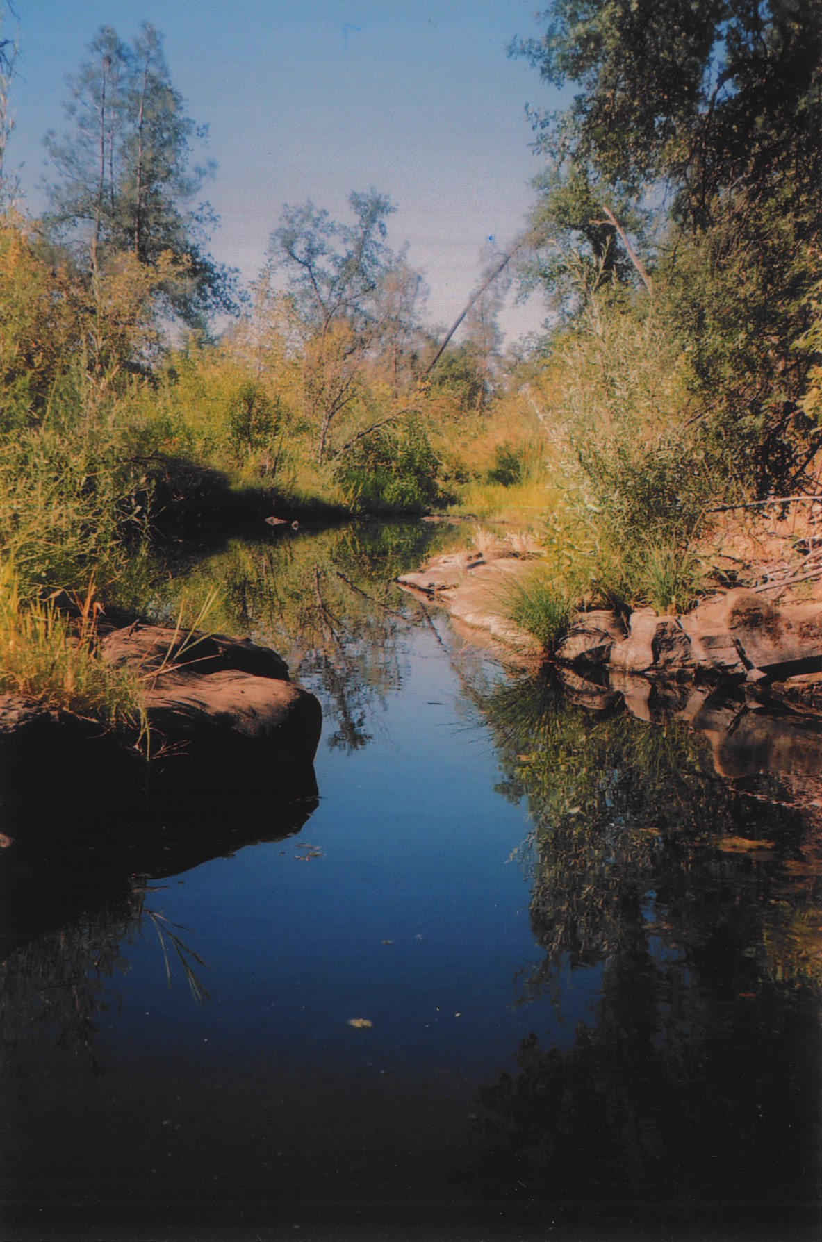
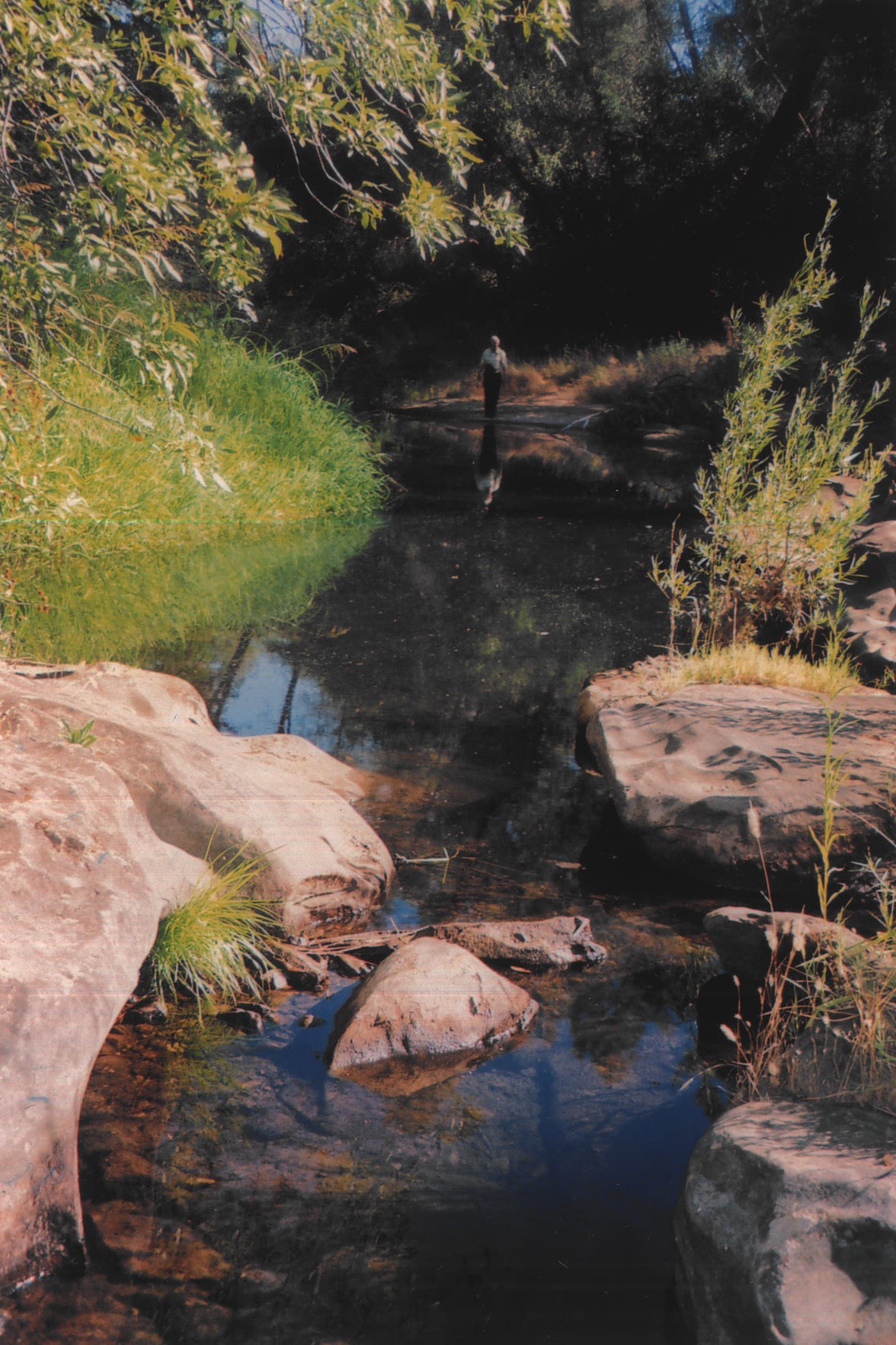
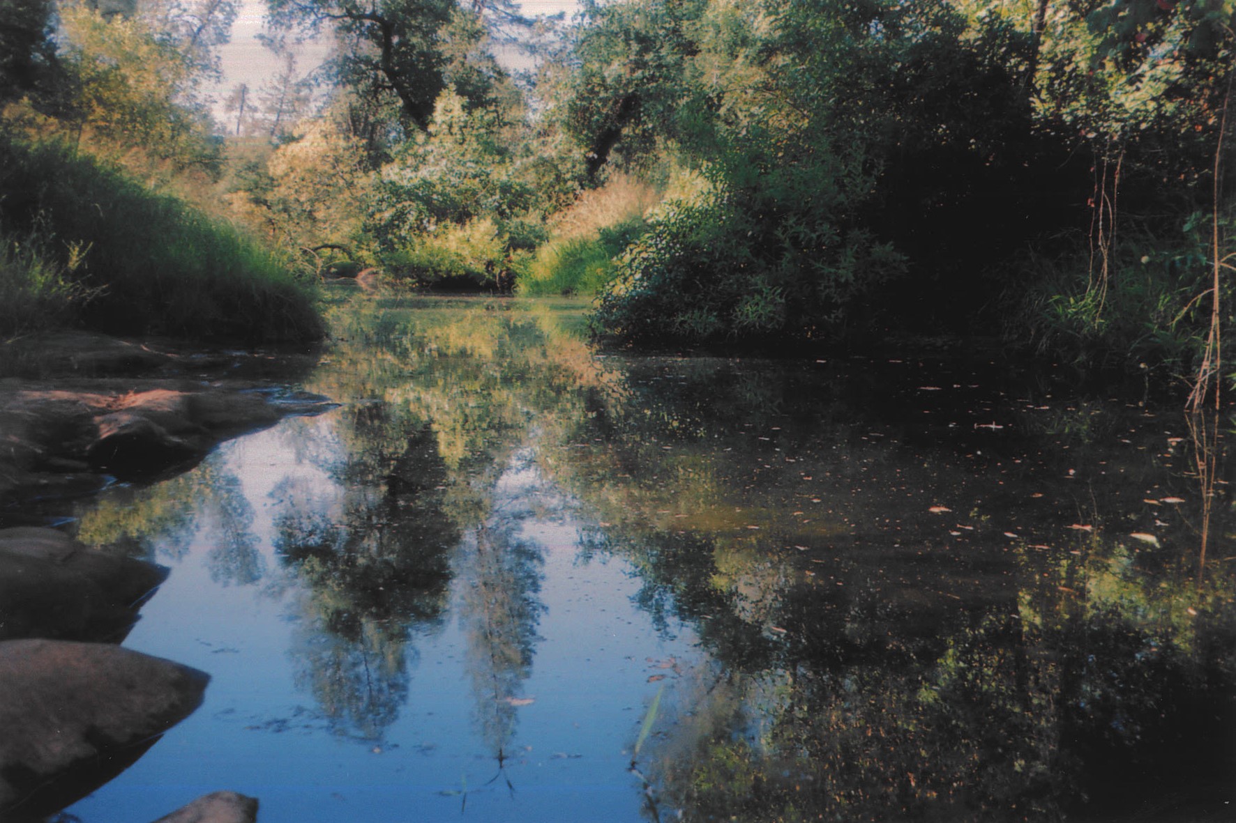
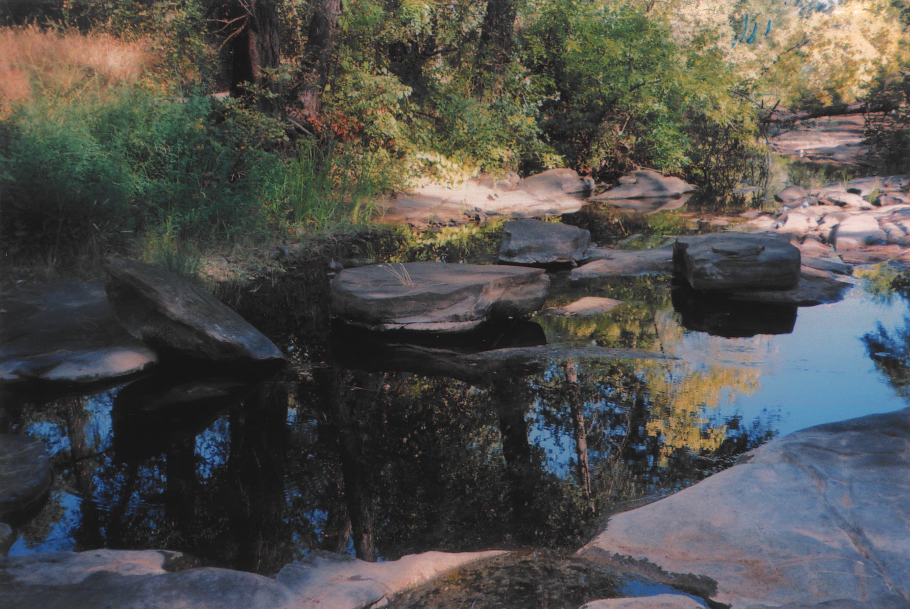
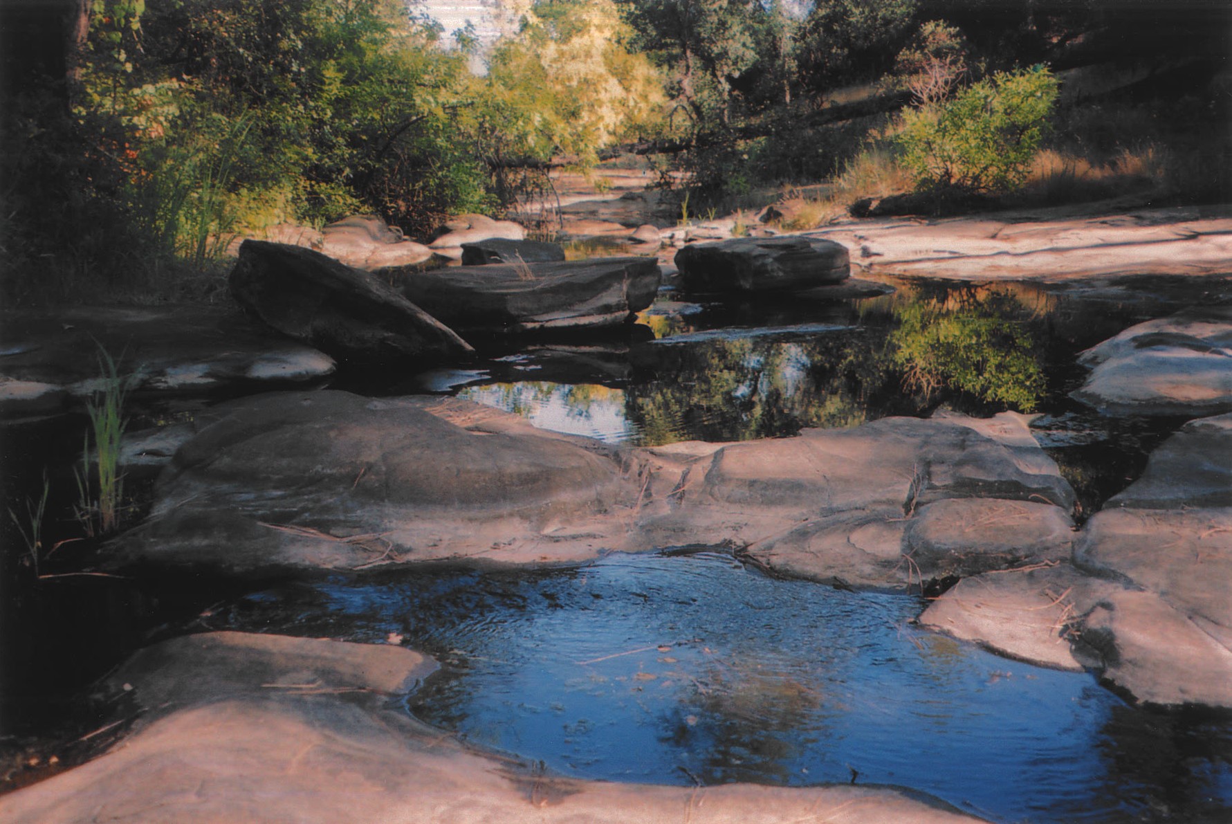
- Between this lot and the two abutting golf course fairways is Halleck Creek, which maintains water for most of the year at the southern end half of this lot - possibly from underground springs.
- Walking this entire lot, including taking in the beauty of the creek at the southern portion of the lot, is like walking in a park.
- Residential construction on this lot will provide magnificent, unobstructed views of the sunset and hillsides in the faraway distance to the west.
- This lot had 800 cubic yards of wood debris removed, including removal of 60 trees stumps, along with 260 in-ground tree stumps which were ground down. 300 oak trees in this cleared area with each pruned. It took ten different crews, with heavy equipment, and $40,000.00 to accomplish this over a three-month period. Every receipt is available for review. This was a major endeavor, with the involvement of several government agencies.
- There are no homeowners' association dues related to this property.
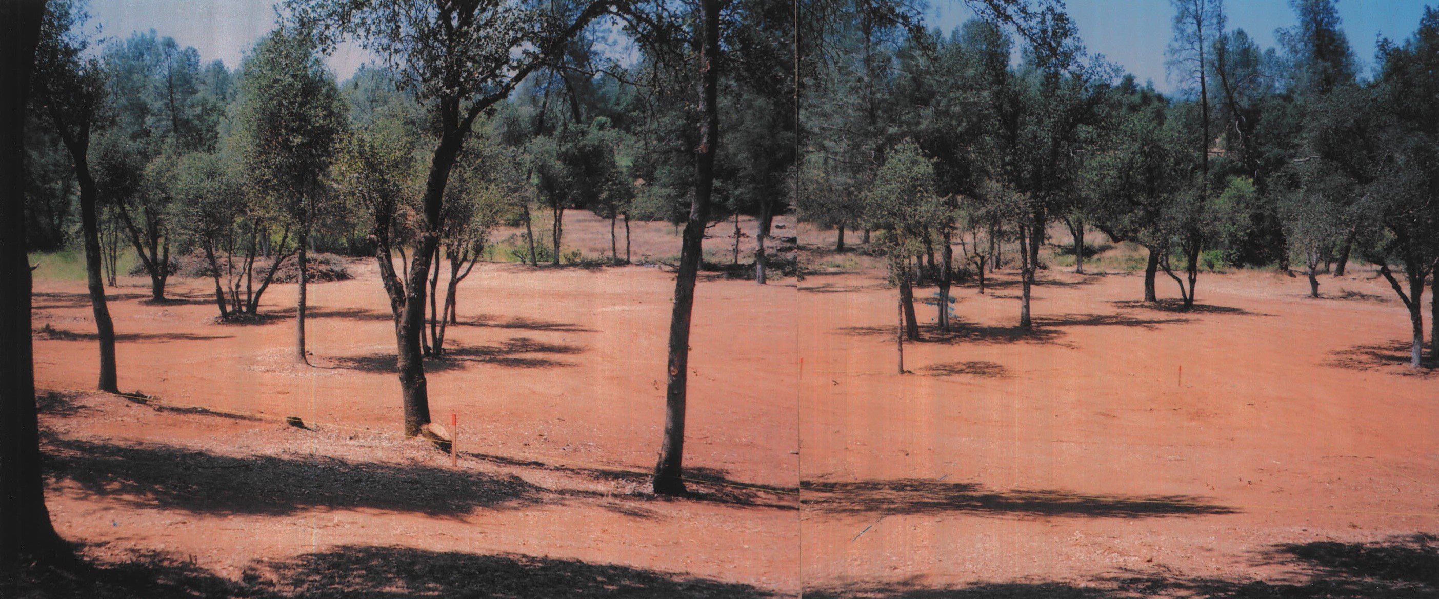
- There is a designated building area on the property, composed of 1.69 acres, recorded in the public records at the Shasta County Recorder's office. It is 130 feet deep by 550 feet in width. However, the City of Redding has an opinion of a very specific area for a proposed residence, which is just beyond where the concrete utility boxes are seen on the front perimeter of the lot.
- Two level acres, without trees, debris, or obstructions, exists between the building pad and the creek. This area could accommodate a substantial gathering of guests for a major homeowner event. There is enough frontage along this lot (1,100 linear feet, to accompany parking for over fifty vehicles for such an event - with a depth of 20 feet from the paved area of the City roadway.
- There is absolutely no remaining wood debris or dead or dying trees on the northern three acres of this 5.38 acres lot from Old Oregon Trail and the golf course fairways it abuts to.
- Contrary to what the local Realtors had been representing to prospective buyers, prior to seller taking title, this designated recorded building pad area is only fractionally in any designated flood zone as per the recently designated flood zone maps.
- There exists very substantial and fully complete documentation within twenty specific documents, composed of several hundred pages related to this property and is available for review. The buyer will receive two complete sets of these documents, which also include recent survey drawings, which were filed with the City of Redding Planning Department.
- There exists an underground City of Redding electric line and cover box on the building pad.
- There also exists an underground telephone line and cover box on the building pad.
- In addition, there is an underground television cable line and cover box on the building pad.
- There also exists a Bella Vista Water Company water line and cover box (without meter).
- There is a fire hydrant directly across the street from the designated building pad for this lot.
- The balance of the existing bond, of about $3,000.00 will be paid by seller at close of escrow.
- There are no known remaining fully developed residential acreage lots of two acres, or more, available for sale in the incorporated City of Redding.
- The property is located in an area of fine homes. There are five homes currently for sale in the Tierra Oaks subdivision, in the list price range of $769,000.00 to $950,000.00.
(19581 San Vincente Drive, 13457 Tierra Heights Road, 19398 Palermo Drive, 13355 Tierra Heights Road, and 13404 Tierra Heights Road). - There are over 100 estate homes in the adjacent Tierra Oaks Golf Club subdivision.
- The adjacent Tierra Oaks Golf Club is an 18-hole championship golf course. This par 72 golf course shares the design element with Pebble Beach and Saint Andrews. The golf course opened in the summer of 1993 and was featured on the cover, and with an article inset, in the Northern California Golf Association magazine at that time.
- The Clubhouse is fashioned in the Southern Georgian style and it also overlooks Stillwater Creek. It was constructed in July of 1994, and is the focal point at the end of the long driveway entrance and a relaxing point for both golfers and the local general population. It is located at 19700 La Crescenta Drive, Redding, California, a half mile north of this lot.
- At the Interstate Freeway turn-off to reach this property, there is what is known as the Oasis Road Specific Plan. This Plan establishes land-use designations and development policies for this 762 acre area generally surrounding the Interstate 5 and Oasis Road interchange. Development potential in the plan area includes approximately 3 million square feet of commercial development and 2,500 residential units. As per the City of Redding's February, 2011, "Project Status Report," Levenson Development Company ("LDC") and the City of Redding continue to work on delivery of an interchange improvement and options for financing the infrastructure improvements needed for the Oasis Center Phase One and other development being considered in the area. Currently being completed is the addition of a southbound loop onramp and traffic signals at the freeway ramps, which should be accomplished by mid-year of 2011. The Project Study Report ("PSR") was approved by Caltrans on September 10, 2009, and other milestones including FHWA approval, environmental compliance, and contract package for construction of the project received December, 2009, approvals.
- Redding is an incorporated city with a population of almost 90,000 residents. It maintains the largest business hub north of Sacramento, which is 160 miles away, all the way to Oregon. There is no larger hub to the west through to the Pacific Ocean, or to the Nevada border.
- The substantial business district, composed of over 400 entities, is five miles south, on the east side of Interstate Highway 5, known as the Churn Creek Road corridor. New upscale businesses, hotels, restaurants, and retailers exist along this three mile corridor. There is nothing else, except an auto row, needed to fully complete this business district.
IF YOU CAN FIND A NICER LOT THAN THIS IN REDDING I WOULD LIKE TO KNOW!